What to Really Expect When Visiting The Arch in Cabo San Lucas
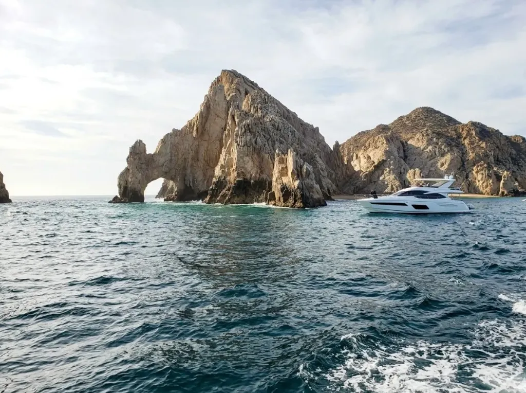
One of the biggest draws of a yacht tour is a visit to The Arch of Cabo San Lucas, the rock formation at Land's End where Pacific Ocean conditions meet the Gulf of California (Sea of Cortez). In practice, it helps to understand how that stop works so you can plan the rest of the day with confidence.
The key idea is simple: when sea state is more active or boat traffic is heavier, time near The Arch is often short and kept at a prudent distance; then the route continues in bays that are more comfortable for swimming, lounging, or snorkeling. That is not a "bad tour" - it is professional operation focused on safety and using charter time well.
Sea conditions: why it is not always "like the brochure"
Unlike many promotional photos, the area around The Arch often has variable swell, wind, and steady boat traffic. At the point, Pacific and Gulf of California conditions can change local sea behavior near the rocks. Checking a marine forecast before you go helps set expectations (see sources below).
That is why it is not always possible - or advisable - to stay parked for a long time or get extremely close: the captain prioritizes safe maneuvering while you take photos, video, and enjoy the view.
How long do you usually spend near The Arch?
On many sightseeing-style outings, time near The Arch tends to be brief and variable: often enough for a panoramic pass and the photos you need, while the exact timing depends on sea state, traffic, and the agreed itinerary. That is not an arbitrary limit - it fits the natural flow of a route when safety comes first.
Best timing for photos
- Early morning: usually less boat traffic.
- Sunset: warm light that many guests love for photography.
- Lower-wind days: the sea often feels a bit calmer near the point.
Still, sea conditions always matter; calm water at Land's End is never guaranteed.
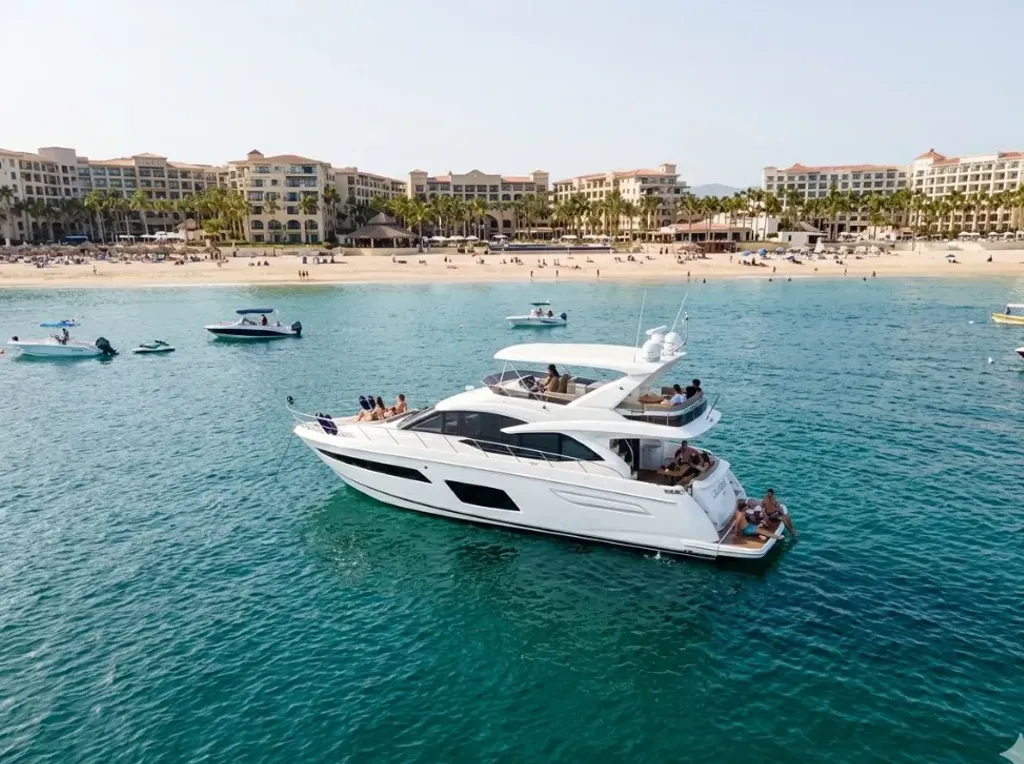
What happens after The Arch (where the experience often takes shape)
After The Arch, the boat typically moves toward more protected areas where it is easier to relax on board, swim, or combine music and service - depending on your charter.
Medano Bay, rocky coves & “El Balconcito”
Medano Beach is the main urban bay in front of the marina: water is generally calmer than at Land's End, the vibe is social, and it is a practical “second half” of the route without sailing too far away.
Toward Land's End, the shoreline follows a chain of granitic rock that culminates at The Arch–the southern tip of the Los Cabos block. That geology (summarized in general-interest sources such as Wikipedia's Arch of Cabo San Lucas article) creates variable seabeds, coves, and water-color contrasts by depth and light–not one single generic bottom across the whole bay.
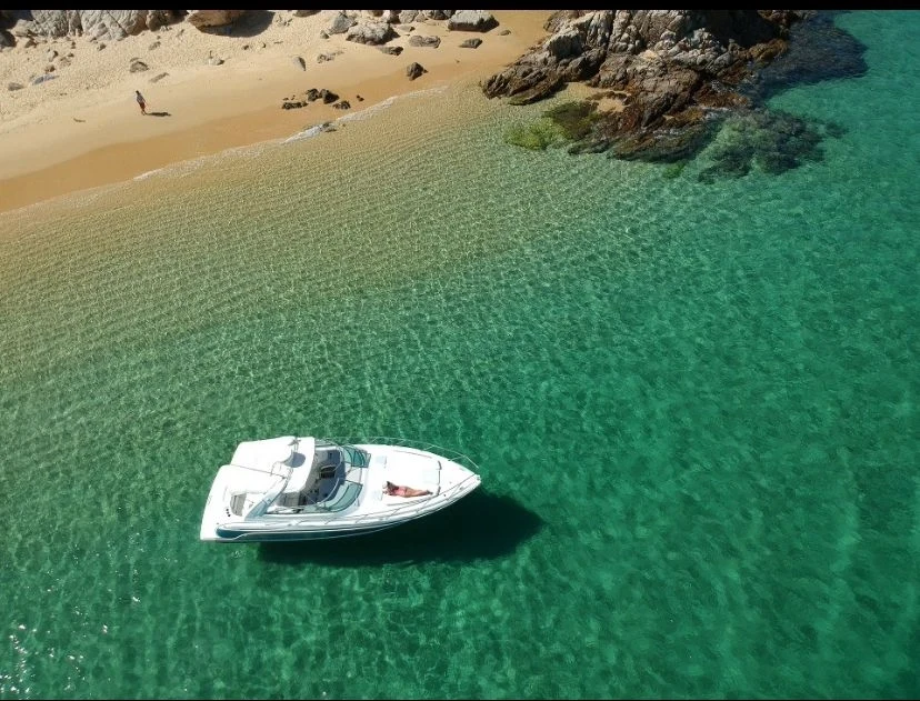
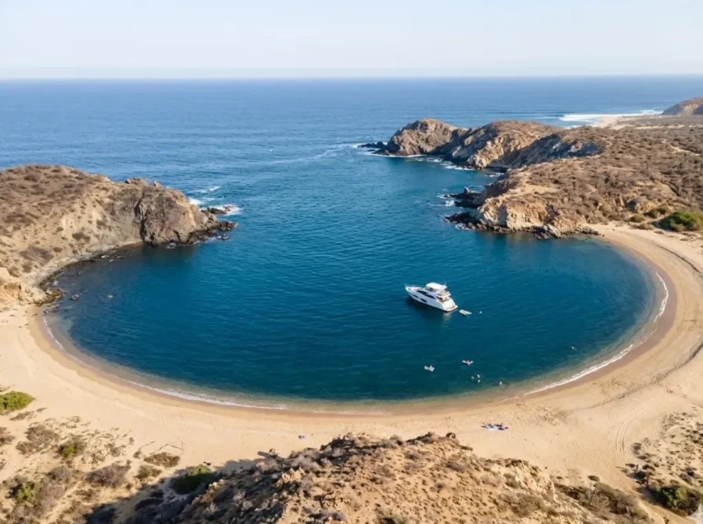
Along the bay and the rocky front leading toward The Arch there are many pockets and stretches of very clear water where swimming and relaxing are often easier than right at the exposed point–when conditions allow, and always under the captain's judgment. The aerial photo below illustrates the kind of crystal-clear cove that forms next to sand and rock on routes in this area.
“El Balconcito” is a local nickname: it does not always appear as one fixed, uniform point on official nautical charts or tourist maps. Sometimes it refers to a particular nook by the rocks near Medano Bay; sometimes it is used more broadly for sheltered pockets between formations. On short trips you cannot count on the same corner every time: demand is high and comfortable spots fill quickly or rotate through the day.
Geology note (general reference): Land's End is mostly granitic rock, formed by ancient intrusive igneous processes; marine erosion carved coves and The Arch itself. For an accessible overview, see the Wikipedia article on the Arch of Cabo San Lucas (linked below).
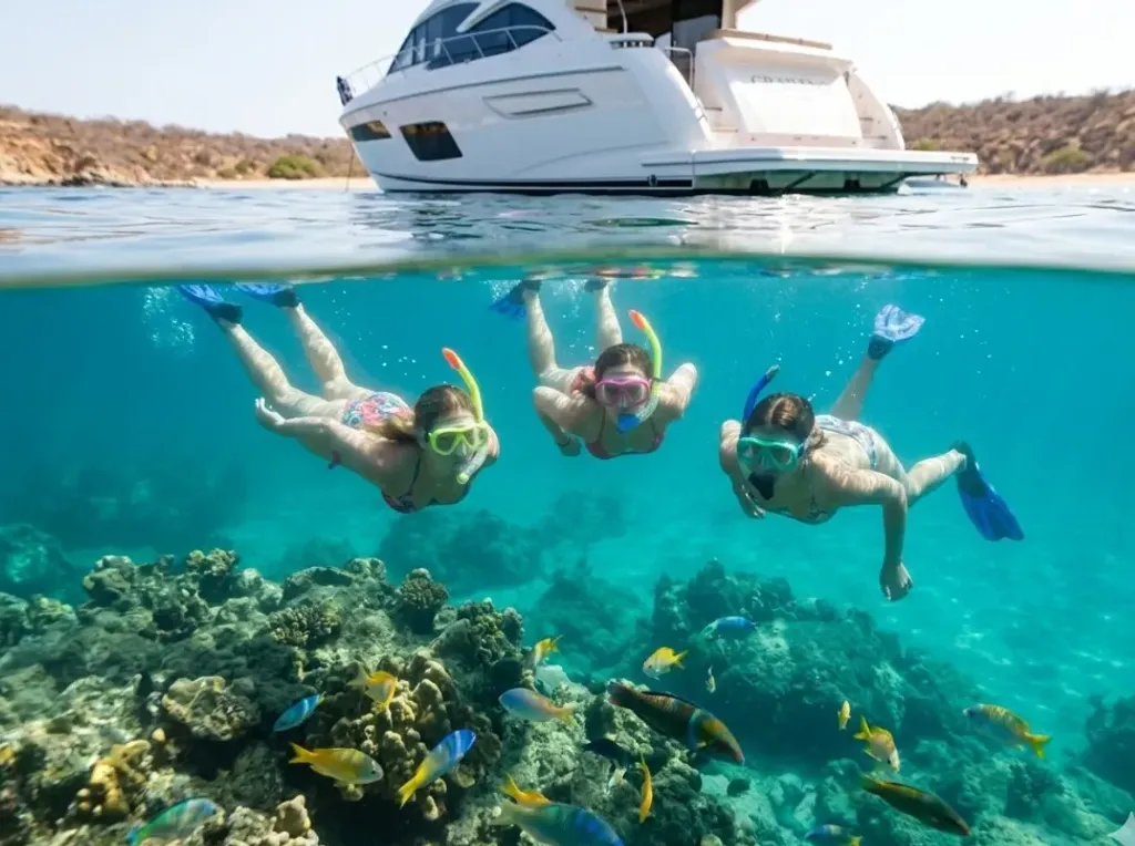
Premium snorkeling stops: Chileno and Santa Maria
If you book 4+ hours, you usually gain enough time to reach protected beaches to the east - popular for snorkeling and relaxed swimming.
- Chileno Beach: rocky reef areas and often good visibility - great if you want active water time.
- Santa Maria Beach: horseshoe bay, generally calm water - a favorite for families.
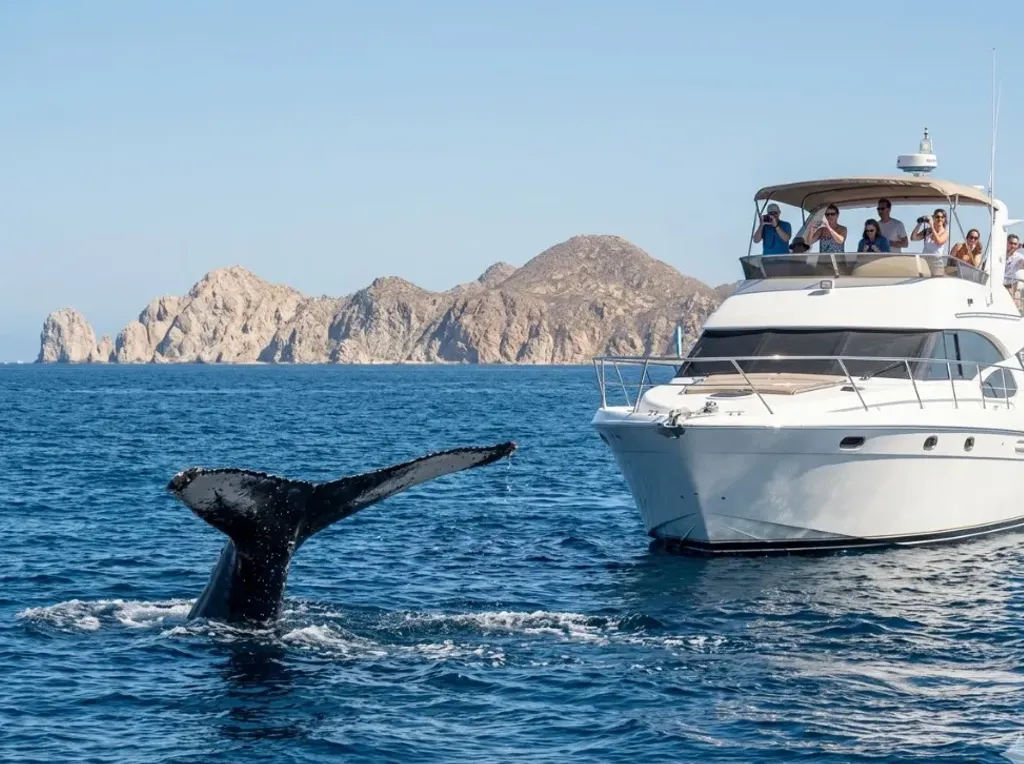
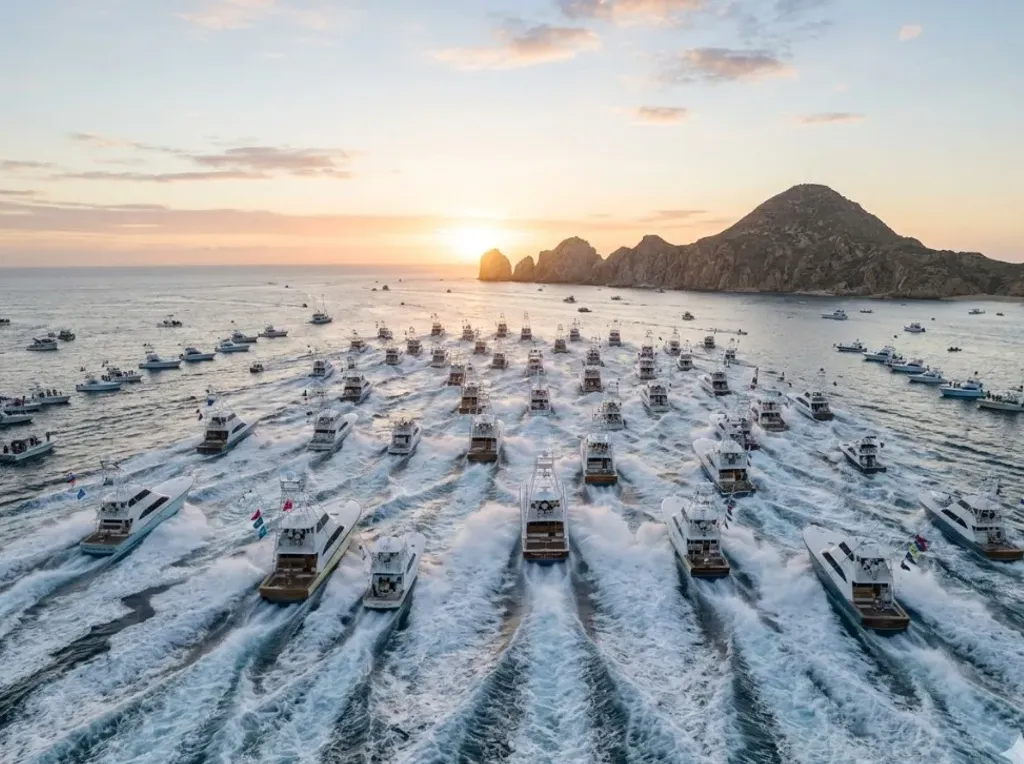
Whale watching, sportfishing, and tournaments: key Los Cabos experiences
Beyond scenic cruises and snorkeling, many travelers specifically look for high-demand thematic outings: whale watching, sportfishing on equipped yachts, and competitive fishing tournaments. Booking with formal operators and clear rules improves safety, logistics, and overall trip quality.
- Whale watching (seasonal): in general, Los Cabos sees its strongest window during winter and spring, with notable humpback activity and other migratory species.
- Sportfishing: Los Cabos runs year-round; target species and tactics vary by season, area, and vessel type.
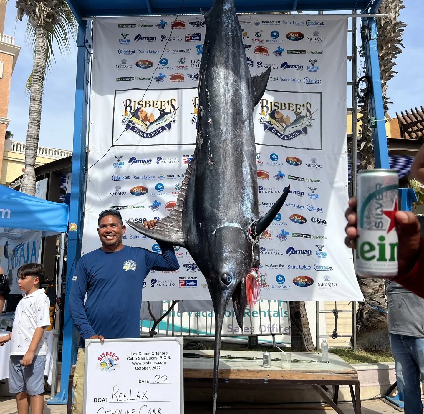
- Tournaments: events like Bisbee's and Tuna Jackpot gather large fleets, formal rules, and international visibility.
In recreational and tournament-style fishing, responsible catch-and-release practices (when applicable) are essential to protect fisheries and sustain long-term sportfishing quality.
How to choose the right tour
A common mistake is assuming everything happens at The Arch. In practice, The Arch is the iconic - and usually short - stop; longer swimming, snorkeling, or onboard celebration typically happens in other bays, depending on hours and conditions.
Always ask what a departure includes (Land's End only vs extended route) and align that with your goal: photos, swimming, snorkeling, or celebration.
Recommended duration by objective
- 2-3 hours: The Arch + nearby bay (e.g., Medano area); focused on views and photos.
- 4 hours: a realistic window for snorkeling at Chileno or Santa Maria, depending on navigation time.
- 6+ hours: a more relaxed pace and more flexibility if the sea changes the plan.
For more planning context, see the main Cabo yacht rental questions & guides.
Expectations vs reality
| Common expectation | Typical reality |
|---|---|
| A long stationary stop right at The Arch | The stop is often short and variable; safety comes first |
| Flat water everywhere on the same day | The point can be rougher than protected bays |
| All charter value happens in one spot | The route links multiple points depending on duration and sea state |
Safety and planning
Keeping prudent distance or shortening time at The Arch when conditions are active does not reduce charter value - it avoids unnecessary maneuvering and helps you use time better in calmer sections.
Booking with aligned expectations usually improves satisfaction, especially for mixed groups and first-time visitors.
Verified sources (documentation base)
- Wikipedia - Arch of Cabo San Lucas (encyclopedic overview)
- Wikipedia - Cabo San Lucas (geography and coastal context)
- NOAA / NWS - Marine forecast (Mexico border south waters)
- NOAA Fisheries - Humpback whale migration research
- Blue Flag - International environmental programme for beaches and marinas
- Wikipedia - Humpback whale (migration and ecology)
- Wikipedia - Bisbee's Black & Blue Marlin Tournament
- Wikipedia - Fishing tournament (general tournament structure)
- CONAPESCA (Mexico) - Federal fisheries and aquaculture authority
- NOAA Fisheries - Catch and release fishing best practices